
Leest topographic map
Interactive map
Click on the map to display elevation.
About this map
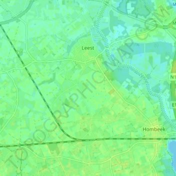
Name: Leest topographic map, elevation, terrain.
Location: Leest, Mechelen, Antwerpen, Vlaanderen, België (51.01060 4.37009 51.04054 4.43607)
Average elevation: 6 m
Minimum elevation: -1 m
Maximum elevation: 12 m
Leest ligt op een hoogte van ongeveer 10 meter. Het ligt aan de Zenne en aan de Molenbeek die hier in de Zenne uitmondt.
Other topographic maps
Click on a map to view its topography, its elevation and its terrain.