
Harmandalı topographic map
Interactive map
Click on the map to display elevation.
About this map
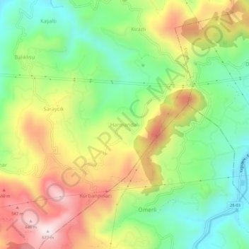
Name: Harmandalı topographic map, elevation, terrain.
Location: Harmandalı, Keşap, Giresun, Black Sea Region, Turkey (40.87564 38.58981 40.91564 38.62981)
Average elevation: 323 m
Minimum elevation: 60 m
Maximum elevation: 672 m