
Sanilac County topographic map
Interactive map
Click on the map to display elevation.
About this map
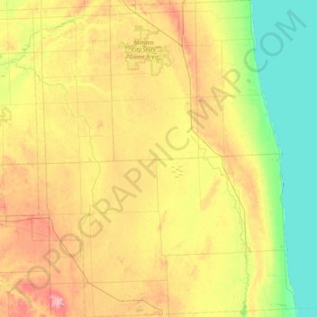
Name: Sanilac County topographic map, elevation, terrain.
Location: Sanilac County, Michigan, United States of America (43.15410 -83.12039 43.69044 -82.50316)
Average elevation: 228 m
Minimum elevation: 172 m
Maximum elevation: 317 m
Other topographic maps
Click on a map to view its topography, its elevation and its terrain.
Ann Arbor
United States of America > Michigan > Ann Arbor
Ann Arbor, Washtenaw County, Michigan, United States of America
Average elevation: 268 m
Washtenaw County
United States of America > Michigan
Washtenaw County, Michigan, United States of America
Average elevation: 267 m