
Christoval topographic map
Click on the map to display elevation.
About this map
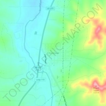
Name: Christoval topographic map, elevation, terrain.
Location: Christoval, Tom Green County, Texas, 76935, United States (31.17456 -100.51538 31.21456 -100.47538)
Average elevation: 643 m
Minimum elevation: 608 m
Maximum elevation: 729 m
Other topographic maps
Click on a map to view its topography, its elevation and its terrain.