
Huldenberg topographic map
Interactive map
Click on the map to display elevation.
About this map
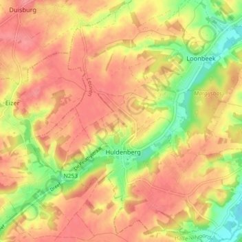
Name: Huldenberg topographic map, elevation, terrain.
Location: Huldenberg, Louvain, Brabant flamand, Belgique (50.77265 4.55532 50.81753 4.62788)
Average elevation: 75 m
Minimum elevation: 28 m
Maximum elevation: 103 m