
El Huaxtho topographic map
Interactive map
Click on the map to display elevation.
About this map
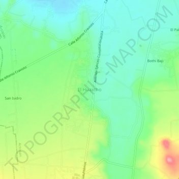
Name: El Huaxtho topographic map, elevation, terrain.
Location: El Huaxtho, Actopan, Hidalgo, 42601, México (20.21413 -98.98292 20.25413 -98.94292)
Average elevation: 2,005 m
Minimum elevation: 1,964 m
Maximum elevation: 2,088 m
Other topographic maps
Click on a map to view its topography, its elevation and its terrain.
Colonia Cuauhtémoc
Colonia Cuauhtémoc, Actopan, Hidalgo, 42601, México
Average elevation: 2,052 m