
Thank you for supporting this site ❤️
Make a donation
Make a donation
Loganton topographic map
Click on the map to display elevation.
Thank you for supporting this site ❤️
Make a donation
Make a donation
About this map
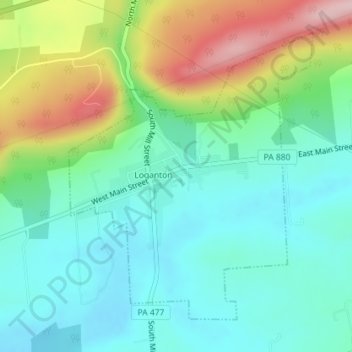
Name: Loganton topographic map, elevation, terrain.
Location: Loganton, Clinton County, Pennsylvania, United States (41.02358 -77.31522 41.04560 -77.29038)
Average elevation: 432 m
Minimum elevation: 363 m
Maximum elevation: 592 m
Thank you for supporting this site ❤️
Make a donation
Make a donation
Other topographic maps
Click on a map to view its topography, its elevation and its terrain.
Farrandsville
United States > Pennsylvania > Clinton County > Colebrook Township
Average elevation: 293 m
Thank you for supporting this site ❤️
Make a donation
Make a donation
Riverview
United States > Pennsylvania > Clinton County > Bald Eagle Township > Riverview
Average elevation: 295 m