
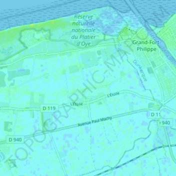
Le Banc à Groseilles topographic map
Interactive map
Click on the map to display elevation.
About this map
Name: Le Banc à Groseilles topographic map, elevation, terrain.
Average elevation: 2 m
Minimum elevation: -3 m
Maximum elevation: 10 m
Other topographic maps
Click on a map to view its topography, its elevation and its terrain.
Les Ecardines
France > Hauts-de-France > Pas-de-Calais > Oye-Plage
Les Ecardines, Oye-Plage, Calais, Pas-de-Calais, Hauts-de-France, France métropolitaine, 62215, France
Average elevation: 1 m