
Schrambach topographic map
Interactive map
Click on the map to display elevation.
About this map
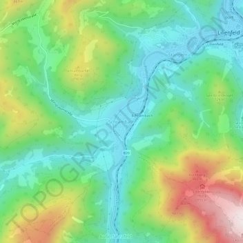
Name: Schrambach topographic map, elevation, terrain.
Average elevation: 606 m
Minimum elevation: 367 m
Maximum elevation: 1,097 m
Other topographic maps
Click on a map to view its topography, its elevation and its terrain.
Muckenkogel
Österreich > Niederösterreich > Bezirk Lilienfeld > Gemeinde Lilienfeld
Muckenkogel, Gemeinde Lilienfeld, Bezirk Lilienfeld, Niederösterreich, 3180, Österreich
Average elevation: 897 m