
Make a donation
Saint Joseph topographic map
Click on the map to display elevation.
Make a donation
Saint Joseph
Under the Köppen climate classification, St. Joseph has a humid subtropical climate (Cfa) bordering on a humid continental climate (Dfa), although under United States isotherms of 32 °F (0 °C) the station is firmly continental. The monthly weather averages listed below are taken from National Weather Service 1981-2010 Normals recorded at Rosecrans Airport. Because of the Airport's location near the Missouri River and at a low elevation, official overnight lows during wintertime especially are often several degrees colder than at other places within the city. Snowfall is not recorded at the St Joseph weather station although surrounding reporting stations typically receive 12-20 inches of snowfall annually.
Make a donation
About this map
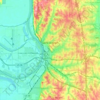
Name: Saint Joseph topographic map, elevation, terrain.
Location: Saint Joseph, Buchanan County, Missouri, United States (39.69722 -94.89903 39.82126 -94.74334)
Average elevation: 277 m
Minimum elevation: 241 m
Maximum elevation: 343 m
Make a donation
Other topographic maps
Click on a map to view its topography, its elevation and its terrain.