
燕郊镇 topographic map
Interactive map
Click on the map to display elevation.
About this map
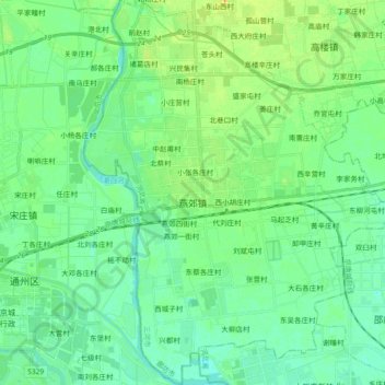
Name: 燕郊镇 topographic map, elevation, terrain.
Location: 燕郊镇, 三河市, 廊坊市, 河北省, 中国 (39.87688 116.75114 40.01814 116.89932)
Average elevation: 25 m
Minimum elevation: 15 m
Maximum elevation: 46 m
Other topographic maps
Click on a map to view its topography, its elevation and its terrain.