
Le Blosne topographic map
Interactive map
Click on the map to display elevation.
About this map
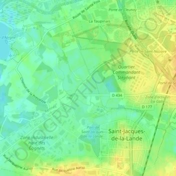
Name: Le Blosne topographic map, elevation, terrain.
Average elevation: 29 m
Minimum elevation: 17 m
Maximum elevation: 41 m
Other topographic maps
Click on a map to view its topography, its elevation and its terrain.
La Vilaine
France > Bretagne > Saint-Jacques-de-la-Lande
La Vilaine, Le Moulin de Champcors, Saint-Jacques-de-la-Lande, Rennes, Ille-et-Vilaine, Bretagne, France métropolitaine, 35136, France
Average elevation: 24 m