
Summit County topographic map
Interactive map
Click on the map to display elevation.
About this map
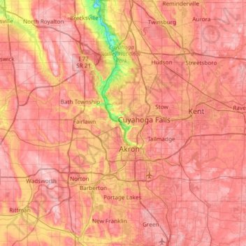
Name: Summit County topographic map, elevation, terrain.
Location: Summit County, Ohio, United States (40.90650 -81.68849 41.35113 -81.39169)
Average elevation: 327 m
Minimum elevation: 187 m
Maximum elevation: 405 m
Summit County is an urban county in the U.S. state of Ohio. As of the 2010 census, the population was 541,781 making it the fourth-most populous county in Ohio. Its county seat is Akron. The county was formed on March 3, 1840, from portions of Medina, Portage and Stark Counties. It was named "Summit County" because the highest elevation on the Ohio and Erie Canal is located in the county.
Other topographic maps
Click on a map to view its topography, its elevation and its terrain.
Washington Court House
United States > Ohio > Fayette County
Washington Court House, Fayette County, Ohio, 43160, United States
Average elevation: 298 m
Cleveland
United States > Ohio > Cuyahoga County > Cleveland
Cleveland, Cuyahoga County, Ohio, 44113, United States
Average elevation: 221 m