
Thank you for supporting this site ❤️
Make a donation
Make a donation
Strawberry Point topographic map
Click on the map to display elevation.
Thank you for supporting this site ❤️
Make a donation
Make a donation
About this map
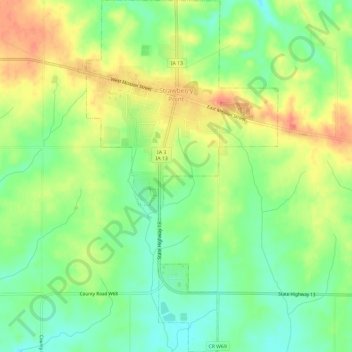
Name: Strawberry Point topographic map, elevation, terrain.
Location: Strawberry Point, Clayton County, Iowa, United States (42.65160 -91.55093 42.69530 -91.51714)
Average elevation: 354 m
Minimum elevation: 329 m
Maximum elevation: 383 m
Thank you for supporting this site ❤️
Make a donation
Make a donation
Other topographic maps
Click on a map to view its topography, its elevation and its terrain.