
Sougueur topographic map
Interactive map
Click on the map to display elevation.
About this map
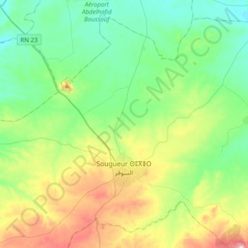
Name: Sougueur topographic map, elevation, terrain.
Location: Sougueur, Daïra Sougueur, Tiaret, Algérie (35.12652 1.28898 35.32383 1.56343)
Average elevation: 1,065 m
Minimum elevation: 949 m
Maximum elevation: 1,355 m
Other topographic maps
Click on a map to view its topography, its elevation and its terrain.
Tousnina
Algérie > Tiaret > Daïra Sougueur
Tousnina, Daïra Sougueur, Tiaret, Algérie
Average elevation: 1,140 m