
Beytüşşebap topographic map
Interactive map
Click on the map to display elevation.
About this map
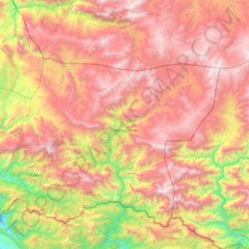
Name: Beytüşşebap topographic map, elevation, terrain.
Location: Beytüşşebap, Şırnak, Southeastern Anatolia Region, Turkey (37.40177 42.63030 37.76984 43.49919)
Average elevation: 2,080 m
Minimum elevation: 663 m
Maximum elevation: 3,387 m
Beytüşşebap (Kurdish: Elkî) is a district of Şırnak Province of Turkey. All of the district is mountainous highland. It receives much snow in winter. It is warm and mild in summer. The largest human settlement is at an elevation of around 1550 meters. The mayor is Habip Aşan of the Justice and Development Party (AKP), as the District Governor (Kaymakam), Hasan Meşel serves since September 2020 after he was appointed by Recep Tayyip Erdoğan.