
Paragon topographic map
Interactive map
Click on the map to display elevation.
About this map
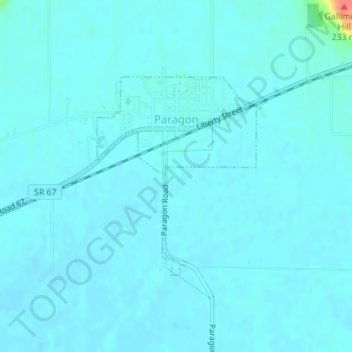
Name: Paragon topographic map, elevation, terrain.
Location: Paragon, Morgan County, Indiana, United States (39.38306 -86.57035 39.39827 -86.55455)
Average elevation: 176 m
Minimum elevation: 171 m
Maximum elevation: 226 m
Other topographic maps
Click on a map to view its topography, its elevation and its terrain.
Landersdale
United States > Indiana > Morgan County
Landersdale, Morgan County, Indiana, 46183, United States
Average elevation: 211 m
Morgantown
United States > Indiana > Morgan County
Morgantown, Morgan County, Indiana, United States
Average elevation: 209 m
Martinsville
United States > Indiana > Morgan County
Martinsville, Morgan County, Indiana, United States
Average elevation: 197 m
Brookmoor
United States > Indiana > Morgan County > Mooresville
Brookmoor, Mooresville, Morgan County, Indiana, 46158, United States
Average elevation: 215 m
Mooresville
United States > Indiana > Morgan County
Mooresville, Morgan County, Indiana, United States
Average elevation: 223 m
Monrovia
United States > Indiana > Morgan County
Monrovia, Morgan County, Indiana, United States
Average elevation: 237 m