
Roche Plate topographic map
Interactive map
Click on the map to display elevation.
About this map
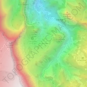
Name: Roche Plate topographic map, elevation, terrain.
Location: Roche Plate, Saint-Paul, Réunion, France (-21.08894 55.38432 -21.04894 55.42432)
Average elevation: 1,320 m
Minimum elevation: 471 m
Maximum elevation: 2,365 m