
Vicente Guerrero topographic map
Interactive map
Click on the map to display elevation.
About this map
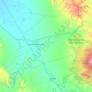
Name: Vicente Guerrero topographic map, elevation, terrain.
Location: Vicente Guerrero, Durango, México (23.59237 -104.13860 23.86097 -103.81620)
Average elevation: 2,104 m
Minimum elevation: 1,865 m
Maximum elevation: 3,099 m