
Sandusky topographic map
Interactive map
Click on the map to display elevation.
About this map
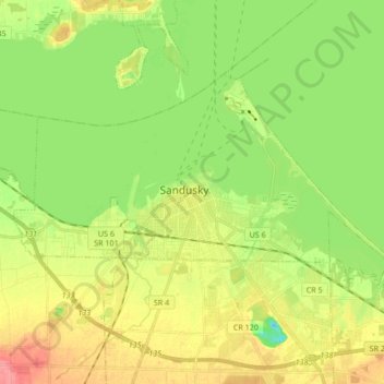
Name: Sandusky topographic map, elevation, terrain.
Location: Sandusky, Erie County, Ohio, 44870, United States (41.41663 -82.78654 41.49936 -82.61772)
Average elevation: 177 m
Minimum elevation: 145 m
Maximum elevation: 217 m
Other topographic maps
Click on a map to view its topography, its elevation and its terrain.
Sandusky
United States > Ohio > Erie County > Sandusky > Sandusky
Sandusky, Erie County, Ohio, 44870, United States
Average elevation: 184 m