
兴业县 topographic map
Interactive map
Click on the map to display elevation.
About this map
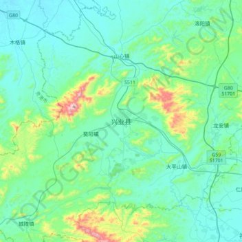
Name: 兴业县 topographic map, elevation, terrain.
Location: 兴业县, 玉林市, 广西壮族自治区, 543000, 中国 (22.57925 109.71099 22.89925 110.03099)
Average elevation: 170 m
Minimum elevation: 50 m
Maximum elevation: 800 m