
Lara topographic map
Interactive map
Click on the map to display elevation.
About this map
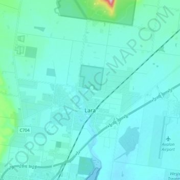
Name: Lara topographic map, elevation, terrain.
Location: Lara, City of Greater Geelong, Victoria, 3212, Australia (-38.06221 144.34095 -37.95905 144.48711)
Average elevation: 25 m
Minimum elevation: 0 m
Maximum elevation: 287 m
Other topographic maps
Click on a map to view its topography, its elevation and its terrain.
You Yangs Regional Park
You Yangs Regional Park, Lara, City of Greater Geelong, Victoria, 3212, Australia
Average elevation: 97 m