
Longaví topographic map
Interactive map
Click on the map to display elevation.
About this map
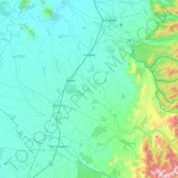
Name: Longaví topographic map, elevation, terrain.
Location: Longaví, Provincia de Linares, Región del Maule, Chile (-36.38840 -71.82505 -35.77946 -71.06179)
Average elevation: 303 m
Minimum elevation: 91 m
Maximum elevation: 1,982 m
Other topographic maps
Click on a map to view its topography, its elevation and its terrain.
La Sexta
Chile > Región del Maule > Longaví > La Sexta
La Sexta, Longaví, Provincia de Linares, Región del Maule, Chile
Average elevation: 237 m