
Petit-Roeulx-lez-Nivelles topographic map
Interactive map
Click on the map to display elevation.
About this map
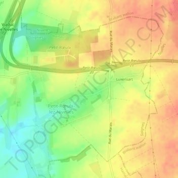
Name: Petit-Roeulx-lez-Nivelles topographic map, elevation, terrain.
Average elevation: 141 m
Minimum elevation: 107 m
Maximum elevation: 167 m
Other topographic maps
Click on a map to view its topography, its elevation and its terrain.
Feluy
België > Henegouwen > Seneffe > Feluy
Feluy, Seneffe, Zinnik, Henegouwen, Wallonië, 7181, België
Average elevation: 113 m
Familleureux
Familleureux, Seneffe, Charleroi, Henegouwen, Wallonië, 7181, België
Average elevation: 120 m