
Dörrensolz topographic map
Interactive map
Click on the map to display elevation.
About this map
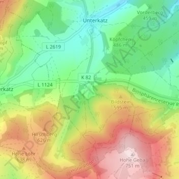
Name: Dörrensolz topographic map, elevation, terrain.
Average elevation: 530 m
Minimum elevation: 376 m
Maximum elevation: 752 m
Other topographic maps
Click on a map to view its topography, its elevation and its terrain.
Metzels
Deutschland > Thüringen > Landkreis Schmalkalden-Meiningen > Wasungen
Metzels, Wasungen, Wasungen-Amt Sand, Landkreis Schmalkalden-Meiningen, Thüringen, Deutschland
Average elevation: 467 m