
La Rue de la Croix topographic map
Interactive map
Click on the map to display elevation.
About this map
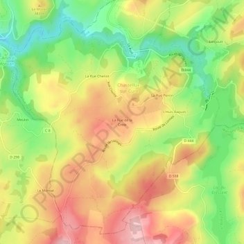
Name: La Rue de la Croix topographic map, elevation, terrain.
Average elevation: 316 m
Minimum elevation: 213 m
Maximum elevation: 415 m
Other topographic maps
Click on a map to view its topography, its elevation and its terrain.
L'huis Raquin
France > Bourgogne-Franche-Comté > Yonne > Chastellux-sur-Cure > L'huis Raquin
L'huis Raquin, Chastellux-sur-Cure, Avallon, Yonne, Bourgogne-Franche-Comté, France métropolitaine, 89630, France
Average elevation: 326 m