
391 topographic map
Interactive map
Click on the map to display elevation.
About this map
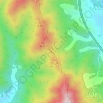
Name: 391 topographic map, elevation, terrain.
Location: 391, Godal-myeon, Gokseong-gun, Jeonnam, South Korea (35.25649 127.39687 35.25659 127.39697)
Average elevation: 279 m
Minimum elevation: 73 m
Maximum elevation: 584 m