
Aïn El Berd topographic map
Interactive map
Click on the map to display elevation.
About this map
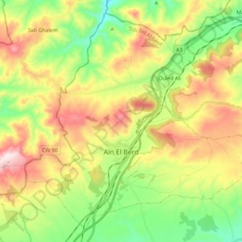
Name: Aïn El Berd topographic map, elevation, terrain.
Location: Aïn El Berd, Daïra Aïn El Berd, Sidi Bel Abbès, Algérie (35.32661 -0.57417 35.44000 -0.41821)
Average elevation: 528 m
Minimum elevation: 271 m
Maximum elevation: 882 m
Other topographic maps
Click on a map to view its topography, its elevation and its terrain.
Sidi Brahim
Algérie > Sidi Bel Abbès > Daïra Aïn El Berd
Sidi Brahim, Daïra Aïn El Berd, Sidi Bel Abbès, Algérie
Average elevation: 447 m