
Thank you for supporting this site ❤️
Make a donation
Make a donation
Heer-Agimont topographic map
Click on the map to display elevation.
Thank you for supporting this site ❤️
Make a donation
Make a donation
About this map
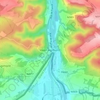
Name: Heer-Agimont topographic map, elevation, terrain.
Location: Heer-Agimont, Hastière, Dinant, Namen, Wallonië, 5543, België (50.15050 4.80266 50.19050 4.84266)
Average elevation: 167 m
Minimum elevation: 93 m
Maximum elevation: 284 m
Thank you for supporting this site ❤️
Make a donation
Make a donation