Mount Imlay topographic map
Click on the map to display elevation.
About this map

Name: Mount Imlay topographic map, elevation, terrain.
Average elevation: 513 m
Minimum elevation: 218 m
Maximum elevation: 858 m
Other topographic maps
Click on a map to view its topography, its elevation and its terrain.
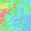
Sydney
Sydney's topography is characterized by a diverse landscape that seamlessly blends coastal features with inland plateaus. The city is divided into two primary regions: the relatively flat Cumberland Plain to the south and west of Sydney Harbour, and the elevated Hornsby Plateau to the north. The Cumberland…
Average elevation: 53 m



Blue Mountains
A sandstone plateau dominated by a landscape of endless eucalyptus forests, the Blue Mountains are located at the top of a 470-million-year-old quartzite. In the Permian period, a shallow sea covered the region, when rivers brought shales, siltstones and mudstones. Then during the Mesozoic period, rivers…
Average elevation: 566 m
















Emmaville
Emmaville is at an elevation of 890 metres AHD. At the 2006 census, the Emmaville "urban centre/locality" had a population of 247 (in the 2001 census it was 303) and there were 535 persons usually resident in the Emmaville region.
Average elevation: 859 m


Castlecrag
The roads of Castlecrag were planned to suit the topography of the area; following the natural contours of the land. This contrasted with the grid plan, which was characteristic of many suburbs in Sydney at the time; reflecting the Griffins' belief that the built environment should respect the natural…
Average elevation: 46 m



Sydney
Sydney's topography is characterized by a diverse landscape that seamlessly blends coastal features with inland plateaus. The city is divided into two primary regions: the relatively flat Cumberland Plain to the south and west of Sydney Harbour, and the elevated Hornsby Plateau to the north. The Cumberland…
Average elevation: 53 m