
Abingdon topographic map
Interactive map
Click on the map to display elevation.
About this map
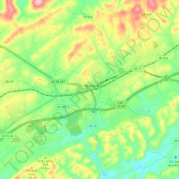
Name: Abingdon topographic map, elevation, terrain.
Location: Abingdon, Washington County, Virginia, USA (36.68498 -82.01956 36.73201 -81.91794)
Average elevation: 646 m
Minimum elevation: 562 m
Maximum elevation: 774 m