
Thank you for supporting this site ❤️
Make a donation
Make a donation
Bleichstetten topographic map
Click on the map to display elevation.
Thank you for supporting this site ❤️
Make a donation
Make a donation
About this map
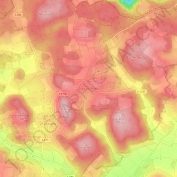
Name: Bleichstetten topographic map, elevation, terrain.
Average elevation: 742 m
Minimum elevation: 593 m
Maximum elevation: 802 m
Thank you for supporting this site ❤️
Make a donation
Make a donation
Other topographic maps
Click on a map to view its topography, its elevation and its terrain.
Würtingen
Deutschland > Baden-Württemberg > Landkreis Reutlingen > St. Johann
Average elevation: 684 m