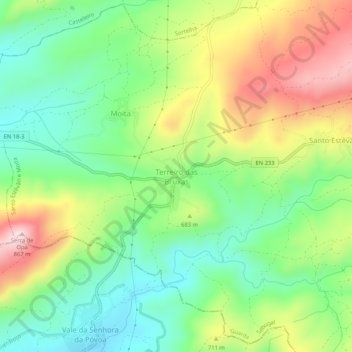
Terreiro das Bruxas topographic map
Interactive map
Click on the map to display elevation.
About this map
Name: Terreiro das Bruxas topographic map, elevation, terrain.
Average elevation: 644 m
Minimum elevation: 504 m
Maximum elevation: 862 m

Click on the map to display elevation.
Name: Terreiro das Bruxas topographic map, elevation, terrain.
Average elevation: 644 m
Minimum elevation: 504 m
Maximum elevation: 862 m