
Thank you for supporting this site ❤️
Make a donation
Make a donation
Alofitai topographic map
Click on the map to display elevation.
Thank you for supporting this site ❤️
Make a donation
Make a donation
About this map
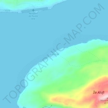
Name: Alofitai topographic map, elevation, terrain.
Location: Alofitai, Alo, Wallis-et-Futuna, 98610, France (-14.34796 -178.07903 -14.30796 -178.03903)
Average elevation: 60 m
Minimum elevation: -1 m
Maximum elevation: 411 m
Thank you for supporting this site ❤️
Make a donation
Make a donation