
Thank you for supporting this site ❤️
Make a donation
Make a donation
Bushehr Province topographic map
Click on the map to display elevation.
Thank you for supporting this site ❤️
Make a donation
Make a donation
About this map
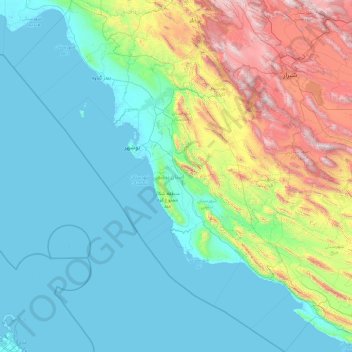
Name: Bushehr Province topographic map, elevation, terrain.
Location: Bushehr Province, Iran (26.98941 49.58014 30.29496 52.91341)
Average elevation: 501 m
Minimum elevation: -3 m
Maximum elevation: 3,149 m
Thank you for supporting this site ❤️
Make a donation
Make a donation