

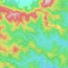
Samford Valley topographic map
Click on the map to display elevation.
About this map

Name: Samford Valley topographic map, elevation, terrain.
Location: Samford Valley, Brisbane, Queensland, Australia (-27.39181 152.83077 -27.34917 152.90739)
Average elevation: 109 m
Minimum elevation: 35 m
Maximum elevation: 492 m
Other topographic maps
Click on a map to view its topography, its elevation and its terrain.







Caboolture Region Environmental Education Centre
Australia > Queensland > Brisbane
Average elevation: 24 m


