Mutlangen topographic map
Click on the map to display elevation.
Mutlangen
Mutlangen is located between the Welzheim Forest and the Swabian Keuper-Lias Plains on an elevation above the Rems valley. The neighboring communes of Mutlangen are Durlangen in the north, the city of Schwäbisch Gmünd in the east and south as well as Alfdorf in the west. Mutlangen consists of the small town Mutlangen and the hamlet Pfersbach, which belongs to Mutlangen since 1 April 1973.
About this map
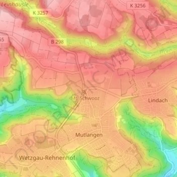
Name: Mutlangen topographic map, elevation, terrain.
Average elevation: 448 m
Minimum elevation: 337 m
Maximum elevation: 508 m
Other topographic maps
Click on a map to view its topography, its elevation and its terrain.
Wilflingen
Germany > Baden-Württemberg > Ostalbkreis > Abtsgmünd
The main town of Abtsgmünd lies at the confluence of the Lein river into the Kocher (confluence elevation 367.4 m above sea level), predominantly on the left bank of the Kocher and left bank of the Lein. The furthest district of Untergröningen lies over 8 km west-northwest as the crow flies along two river…
Average elevation: 432 m

Kapfenburg
Germany > Baden-Württemberg > Ostalbkreis > Lauchheim > Domäne Kapfenburg
Average elevation: 559 m