
Thank you for supporting this site ❤️
Make a donation
Make a donation
Bras Sec topographic map
Click on the map to display elevation.
Thank you for supporting this site ❤️
Make a donation
Make a donation
About this map
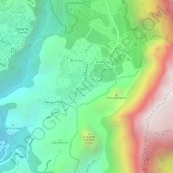
Name: Bras Sec topographic map, elevation, terrain.
Location: Bras Sec, Cilaos, Saint-Pierre, La Réunion, 97413, France (-21.14996 55.47702 -21.13375 55.50560)
Average elevation: 1,448 m
Minimum elevation: 937 m
Maximum elevation: 2,324 m
Thank you for supporting this site ❤️
Make a donation
Make a donation
Other topographic maps
Click on a map to view its topography, its elevation and its terrain.
Thank you for supporting this site ❤️
Make a donation
Make a donation
Thank you for supporting this site ❤️
Make a donation
Make a donation