
Thank you for supporting this site ❤️
Make a donation
Make a donation
Roth topographic map
Click on the map to display elevation.
Thank you for supporting this site ❤️
Make a donation
Make a donation
Roth
Im Geographischen statistisch-topographischen Lexikon von Franken (1801) wird der Ort folgendermaßen beschrieben.
Thank you for supporting this site ❤️
Make a donation
Make a donation
About this map
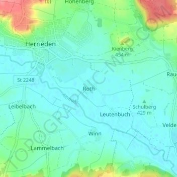
Name: Roth topographic map, elevation, terrain.
Location: Roth, Herrieden, Landkreis Ansbach, Bayern, 91567, Deutschland (49.20590 10.49463 49.24590 10.53463)
Average elevation: 431 m
Minimum elevation: 416 m
Maximum elevation: 486 m
Thank you for supporting this site ❤️
Make a donation
Make a donation