
Heidehuizen topographic map
Interactive map
Click on the map to display elevation.
About this map
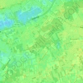
Name: Heidehuizen topographic map, elevation, terrain.
Location: Heidehuizen, Mol, Turnhout, Antwerpen, 2400, België (51.16924 5.12074 51.16934 5.12084)
Average elevation: 27 m
Minimum elevation: 17 m
Maximum elevation: 32 m
Other topographic maps
Click on a map to view its topography, its elevation and its terrain.