
Brinches topographic map
Interactive map
Click on the map to display elevation.
About this map
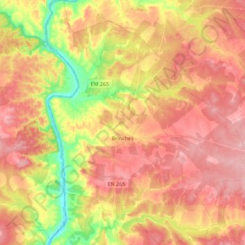
Name: Brinches topographic map, elevation, terrain.
Location: Brinches, Serpa, Beja, Baixo Alentejo, Alentejo, Portugal (37.98199 -7.65405 38.10618 -7.51052)
Average elevation: 136 m
Minimum elevation: 48 m
Maximum elevation: 194 m