
Thank you for supporting this site ❤️
Make a donation
Make a donation
Apeldoorn topographic map
Click on the map to display elevation.
Thank you for supporting this site ❤️
Make a donation
Make a donation
About this map
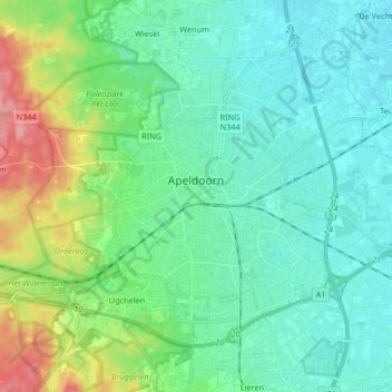
Name: Apeldoorn topographic map, elevation, terrain.
Location: Apeldoorn, Gelderland, Netherlands (52.17264 5.89263 52.25026 6.05825)
Average elevation: 26 m
Minimum elevation: 3 m
Maximum elevation: 99 m
Thank you for supporting this site ❤️
Make a donation
Make a donation