
Thank you for supporting this site ❤️
Make a donation
Make a donation
Nave de Haver topographic map
Click on the map to display elevation.
Thank you for supporting this site ❤️
Make a donation
Make a donation
About this map
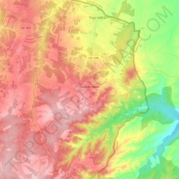
Name: Nave de Haver topographic map, elevation, terrain.
Location: Nave de Haver, Almeida, Guarda, Portugal (40.47668 -6.87177 40.56595 -6.79527)
Average elevation: 790 m
Minimum elevation: 692 m
Maximum elevation: 852 m
Thank you for supporting this site ❤️
Make a donation
Make a donation
Other topographic maps
Click on a map to view its topography, its elevation and its terrain.