
Bloedrivier topographic map
Interactive map
Click on the map to display elevation.
About this map
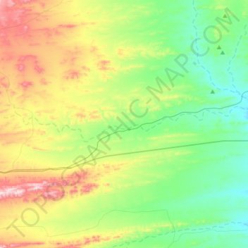
Name: Bloedrivier topographic map, elevation, terrain.
Average elevation: 629 m
Minimum elevation: 460 m
Maximum elevation: 977 m
Other topographic maps
Click on a map to view its topography, its elevation and its terrain.
Matjiesfontein
South Africa > Western Cape > Central Karoo District Municipality > Laingsburg Local Municipality
Matjiesfontein, Laingsburg Local Municipality, Central Karoo District Municipality, Western Cape, 6901, South Africa
Average elevation: 972 m