
Canaan topographic map
Interactive map
Click on the map to display elevation.
About this map
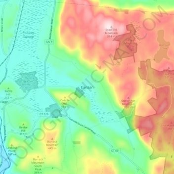
Name: Canaan topographic map, elevation, terrain.
Location: Canaan, Litchfield County, Connecticut, 06031, United States (41.92167 -73.34833 42.00167 -73.26833)
Average elevation: 334 m
Minimum elevation: 160 m
Maximum elevation: 596 m