
Daïra Tiaret topographic map
Interactive map
Click on the map to display elevation.
About this map
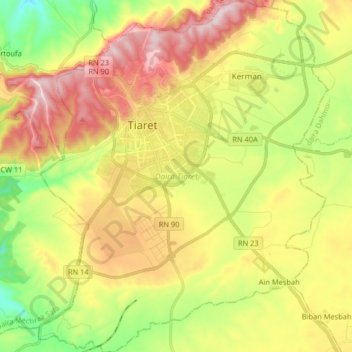
Name: Daïra Tiaret topographic map, elevation, terrain.
Location: Daïra Tiaret, Tiaret, Algérie (35.28023 1.27115 35.41321 1.40531)
Average elevation: 993 m
Minimum elevation: 791 m
Maximum elevation: 1,223 m
Other topographic maps
Click on a map to view its topography, its elevation and its terrain.