
Hochfügen topographic map
Interactive map
Click on the map to display elevation.
About this map
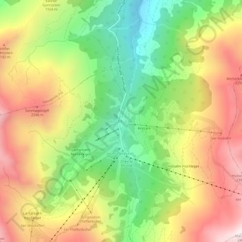
Name: Hochfügen topographic map, elevation, terrain.
Average elevation: 1,844 m
Minimum elevation: 1,269 m
Maximum elevation: 2,476 m
Other topographic maps
Click on a map to view its topography, its elevation and its terrain.
Holzalm
Österreich > Tirol > Bezirk Schwaz > Gemeinde Fügenberg > Hochfügen
Holzalm, Hochfügen, Gemeinde Fügenberg, Bezirk Schwaz, Tirol, Österreich
Average elevation: 1,860 m