
Oberachdorf topographic map
Interactive map
Click on the map to display elevation.
About this map
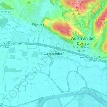
Name: Oberachdorf topographic map, elevation, terrain.
Average elevation: 338 m
Minimum elevation: 316 m
Maximum elevation: 449 m
Other topographic maps
Click on a map to view its topography, its elevation and its terrain.
Wichenbach
Deutschland > Bayern > Landkreis Regensburg > Wörth an der Donau > Tiefenthal
Wichenbach, Tiefenthal, Wörth an der Donau, Wörth an der Donau (VGem), Landkreis Regensburg, Bayern, 93086, Deutschland
Average elevation: 376 m