
Plage du Coz Pors topographic map
Interactive map
Click on the map to display elevation.
About this map
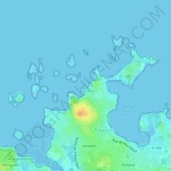
Name: Plage du Coz Pors topographic map, elevation, terrain.
Average elevation: 3 m
Minimum elevation: -1 m
Maximum elevation: 33 m
Other topographic maps
Click on a map to view its topography, its elevation and its terrain.
Île de Costaérès
Île de Costaérès, Trégastel, Lannion, Côtes-d'Armor, Bretagne, France métropolitaine, 22730, France
Average elevation: 4 m
Île Renote
Île Renote, Trégastel, Lannion, Côtes-d'Armor, Bretagne, France métropolitaine, 22730, France
Average elevation: 3 m