
Make a donation
Palm Lake Trailer Court topographic map
Click on the map to display elevation.
Make a donation
About this map
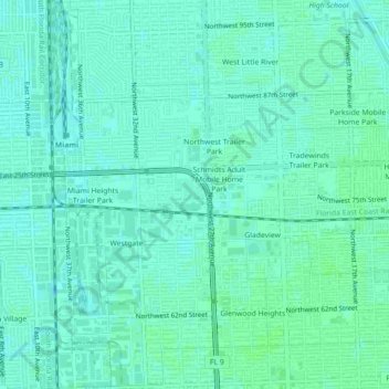
Name: Palm Lake Trailer Court topographic map, elevation, terrain.
Average elevation: 7 m
Minimum elevation: 4 m
Maximum elevation: 10 m
Make a donation
Other topographic maps
Click on a map to view its topography, its elevation and its terrain.
Alice C Wainwright Park
United States > Florida > Miami-Dade County > Miami > Brickell Hammock
Average elevation: 6 m
Make a donation
Make a donation
Florida City
United States > Florida > Miami-Dade County
Florida City is situated mostly atop a limestone ridge called the Miami Rock Ridge that extends south from present day North Miami Beach to a location in Everglades National Park. The ridge, consisting of Miami limestone, serves as the higher ground within the community. The ridge extended from northeast to…
Average elevation: 3 m
Make a donation
Make a donation
Make a donation
Make a donation
Make a donation
Tamiami
United States > Florida > Miami-Dade County > University Lakes Mobile Home Park
Average elevation: 6 m
Burke Recreation Center
United States > Florida > Miami-Dade County > Biscayne Park
Average elevation: 9 m
Richmond Heights
United States > Florida > Miami-Dade County > Richmond Heights
Average elevation: 6 m
Make a donation
South Miami Heights
United States > Florida > Miami-Dade County > South Miami Heights
Average elevation: 6 m
Make a donation